Satellite-based services for precision agriculture

Image Image

How can we help?

Field Crop Production: Precision Solutions for Maximizing Profitability

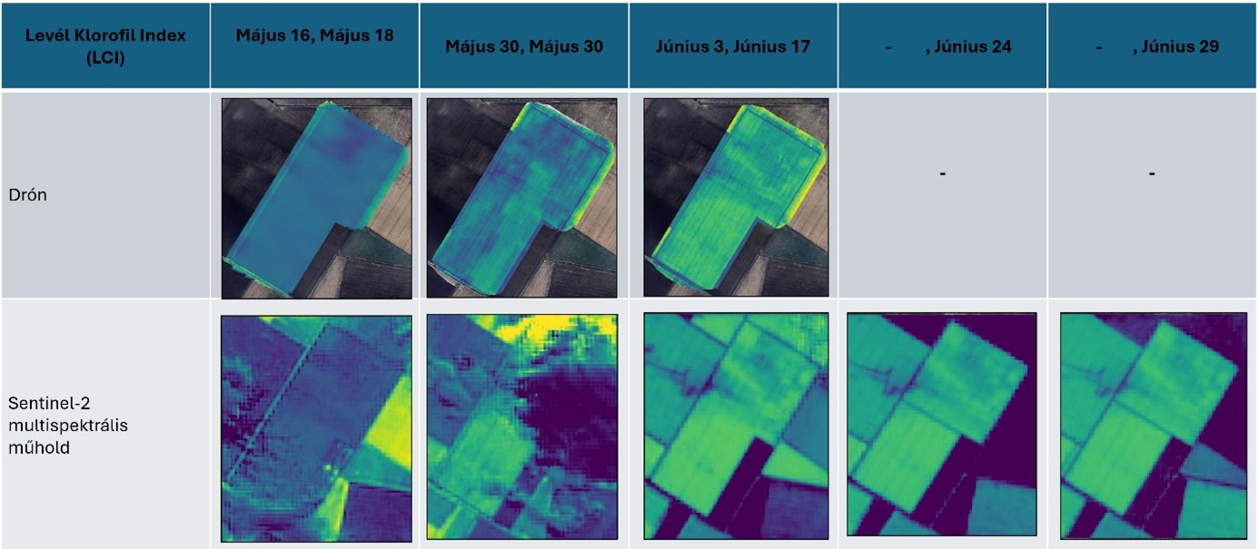
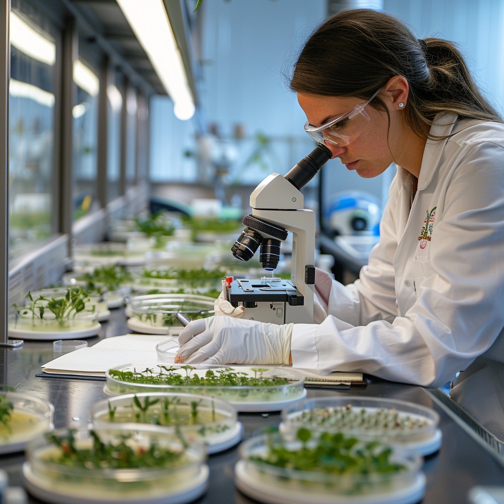
Satellite based vegetation mapping and monitoring provide excellent opportunities to track the development of your crops, orchard or forest with the goal of reducing input costs and increasing income. Nowadays satellites can provide high resolution data of your parcels, multiple times per week, often against very low costs. Thanks to the extensive global coverage of satellite systems, data is collected virtually anywhere in the world. This ensures that we can support agricultural operations, no matter the location.

• Parcel monitoring

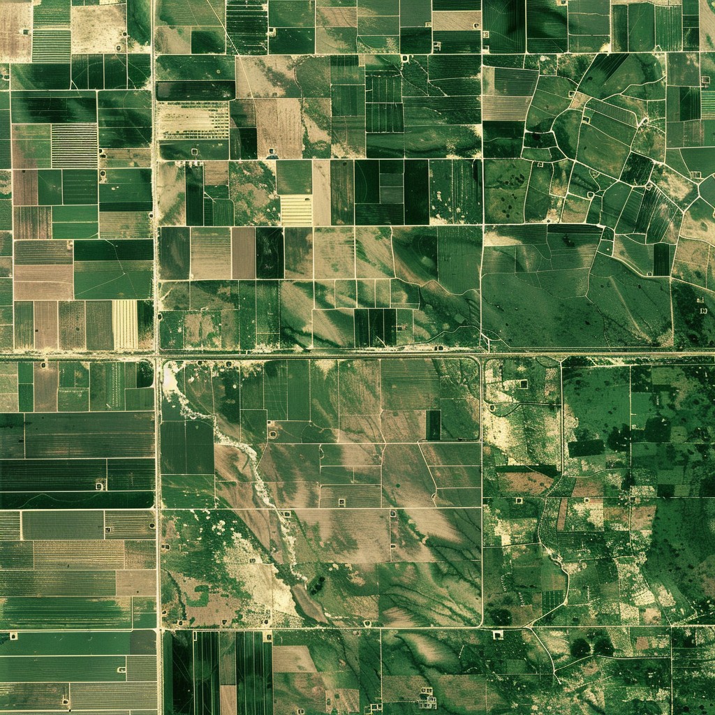
Multispectral data-based vegetation maps with high spatial resolution (from a few square meters to tens of square meters) over very large areas

• Weed assessment

Vegetation maps provide up-to-date information on the location and extent of invasive and other unwanted vegetation

• Disease detection

Irregularities within and between parcels can be a sign of plant diseases

• Pest infestation

Timely detection of pest can help to protect plants and prevent the spread to other areas

• Zonation mapping

Vegetation maps form the basis for zonation maps that show the generalized differences within and between parcels

• Testing of the effectiveness of plant growth stimulants

Satellite data allows for a detailed evaluation of the effect of growth regulators and biostimulants

• Creation of time series databases

The high temporal resolution of satellite data makes it ideal for creating databases that track both historical and current plant and tree growth

How to choose the right method?

Image

For each service, the size of the area and the crop are the determining factors

01
Icon

Parcel montoring

We use multispectral satellite data to generate high-resolution vegetation maps, with details ranging from a few square meters to larger areas. We have the capability to monitor vast agricultural landscapes, providing precise insights into each parcel's status. Our expertise allows us to track changes in crop health over time, helping farmers make informed decisions to maximizes crop yields by enabling precise monitoring based on near real-time data.

02
Icon

Weed assessment

We use vegetation maps to deliver accurate and timely information on the distribution of invasive or unwanted plants. By analysing spectral data, we can distinguish between crops and weeds, enabling targeted management strategies. Our team is equipped to identify invasive species early, reducing the risk of their spread and minimizing crop damage. This targeted approach allows for reduced herbicide use, supporting sustainable agricultural practices.

03
Icon

Disease detection

By comparing vegetation conditions within and between parcels, we can detect subtle irregularities indicating potential disease outbreaks. This allows farmers timely and targeted interventions, minimizing crop loss and disease spread. This helps to maintain healthy crops and supports optimal yields. Our data-driven approach enhances decision-making and ensures the long-term health of agricultural fields.

04
Icon

Pest infestation

By identifying stress indicators in crops using satellite data, we can detect pest infestations. We analyses the imagery to detect changes in vegetation that may suggest the early presence of pests, helping farmers act before infestations spread. This early detection enables focused treatments that reduce the need for widespread pesticide use. Our work helps to protects crop yields and to preserve the surrounding environment

05
Icon

Zonation mapping

Our team developed a new algorithm to derive zonation maps, based on high-quality vegetation data, to highlight variations within and between parcels. We use these maps to support precision agriculture by tailoring management practices—such as fertilization and irrigation—to specific zones. This targeted approach allows for more efficient resource use, and to optimize productivity. Our zonation mapping also identifies soil variations that influence crop performance. We help farmers implement more precise strategies, improving overall farm efficiency and sustainability.

06
Icon

Testing the effectiveness of plant growth stimulants

We leverage satellite data to provide a comprehensive evaluation of plant growth stimulants, including biostimulants and fertilizers. Our team tracks changes in vegetation health and productivity to determine the impact of different treatments.

07
Icon

Creation of time series databases

Our expertise in satellite data allows us to build time series databases that monitor the development of crops over time. These databases combine historical and real-time data to provide a comprehensive view of plant growth patterns.

Results


In addition to delivering the results, we always consult with the client to ensure that the information is best used and integrated into production management. We adapt the form of delivery of the results to your needs. In all cases, we take into account the current geographic information standards!

Image

Services

Let's choose together which service is right for you!